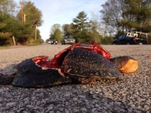
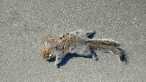
It’s estimated that one million vertebrates are killed on U.S. roadways each day. That’s about one every 11 seconds.
Animals need to move. They move daily to access food and shelter, seasonally to seek protection from heat and cold, and they move throughout their lives as they grow from immature creatures dispersing from “nursery” habitat, to adults seeking mates and nesting habitat.
 As habitats shift due to a changing climate, wildlife movement becomes an important adaptation strategy for species survival as they seek new habitats in a shifting landscape. When roads are built in and through and between habitats, they can impede movements, separate populations, and kill individuals through collisions with vehicles. In this way, roads can have a huge impact on individuals, populations, and entire species of wildlife.
Some species are more vulnerable to the effects of roads than others. The most vulnerable species are those that range widely, move slowly, have low reproductive numbers, and use a variety of habitat types throughout their lives. Species such as endangered species may already have low population numbers, only made worse by loss to roadkill.
And some roads are worse than others. The roads with the highest wildlife mortality rates are those that cross large habitat areas or waterways, that run alongside rivers and streams, and have high traffic volumes and rates of speed.
But there are things we can do, and Maine Audubon is working with partners to make a difference, and you can help!
Below is information on some of the projects Maine Audubon is involved in to understand and mitigate the effects of roads on wildlife in Maine.
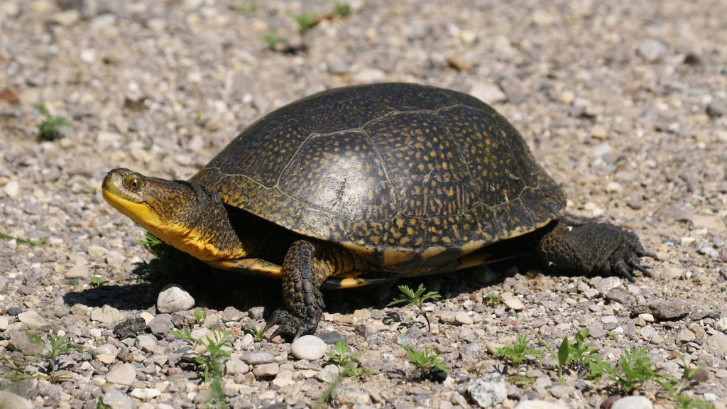
Maine Turtle Roadkill Survey
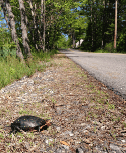
In 2018, Maine Audubon coordinated the first season of a citizen science project aiming to identify stretches of road that have high turtle mortality. This is a three-year project in which citizen science volunteers monitor pre-selected road segments around Maine to help identify which species of turtles are crossing where, and which road crossings are most hazardous to Maine’s turtles. The goal is to collect enough data to help us understand features of the landscape and roadways that might increase or decrease the probability of turtle road mortality. We hope to then use this information to develop mitigation strategies for areas of high turtle roadkill to reduce or eliminate turtle mortality.
For more information, including survey results, protocols, and links to maps and photos of observations, please see our Maine Turtle Roadkill Survey page.
Interested in volunteering? Please contact us at conserve@maineaudubon.org to sign up for training sessions and surveys.
This project is a partnership between Maine Audubon, Maine Department of Inland Fisheries and Wildlife, the Maine Outdoor Heritage Fund, Margaret E. Burnham Charitable Trust, and MaineDOT. It was funded in part by the Maine Outdoor Heritage Fund, in which proceeds from the sale of a dedicated instant lottery ticket are used to support outdoor recreation and natural resource conservation.
![]()
Wildlife Road Watch
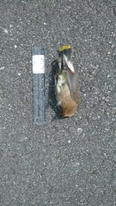
Wildlife Road Watch is a web-based map and database project that records volunteer observations of roadside and road-killed wildlife. Scientists use the data to improve our collective understanding of where wildlife attempt to cross roads, what we can do to reduce roadkill, and how best to improve safety for people and wildlife.
 How you can help
Submit your roadside observations
- Create an account in our system to be able to submit an observation and allow us to identify observations from specific observers.
- Once you have an account, log in to the system.
- Add observations describing what you saw, pinpointing its location on the map, and even uploading your photos (if you took any).
Adopt a road
Volunteers can regularly monitor a section of road throughout the year. They document wildlife crossings, both successful (when you see a live animal on or near the road) and unsuccessful (dead animals on the road or shoulder).
For more information or to sign up to volunteer, please contact Sarah Haggerty at shaggerty@maineaudubon.org or 207.781.2330 x225.
What to do if you find an injured animal
Road Crossing Structure Monitoring
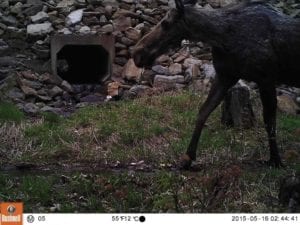 In 2014, Maine Audubon and partners from the Maine Department of Fisheries & Wildlife, Maine Department of Transportation, and the Nature Conservancy piloted a survey of road crossing structures to assess whether they could be retrofitted for terrestrial wildlife movement. The project tested the use of the Passage Assessment System, or PAS, developed for the Washington State Department of Transportation.
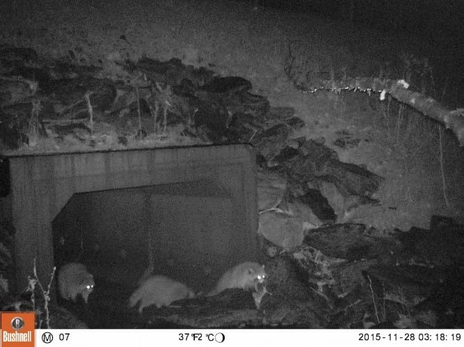
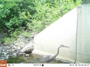 This camera monitoring project’s goal is to determine if wildlife are using different road crossing structures to move safely across roads (even without fencing to direct them to the structures). And if so, what species are using which types of road crossing structures, such as plastic culverts, concrete boxes, and bridges.
Read our 2016 report on this work (PDF).